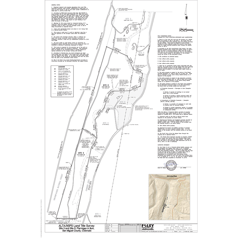
- Typically prepared for commercial or larger high end properties
- Shows improvements (structures), easements, rights-of- way, and other elements impacting the ownership
- Optional Item Requirements (click here to view Table A)
- Prepared to meet the nationally recognized (click here to view ALTA/NSPS standards)
- Certified to the buyer, seller, title company, and lender
- Verifies boundary dimensions and parcel size
- May be recorded with the county to become public record
Click on Map to Download PDF
Land Survey Plat (LSP)
- Shows only the boundary lines, easements and rights of way, no improvements (structures) are shown
- Recovers or restores missing property corners
- Meets the standards of (link to CRS 38-51- 106)
- Verifies boundary dimensions and parcel size
- A current title commitment may be required to shown easements affecting the property
- May be recorded with the county to become public record
Click on Map to Download PDF
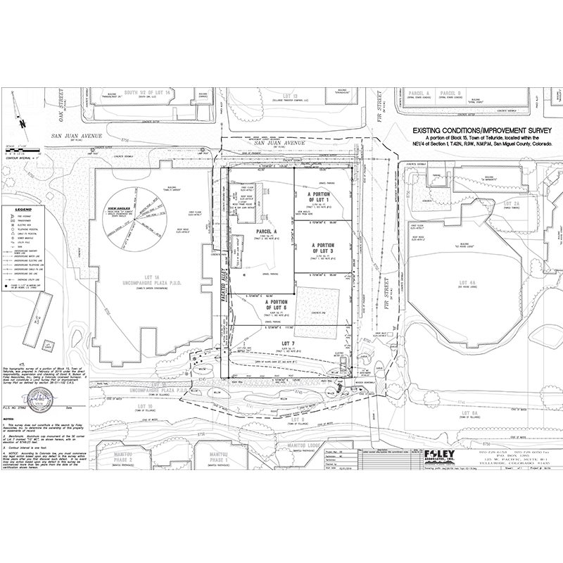
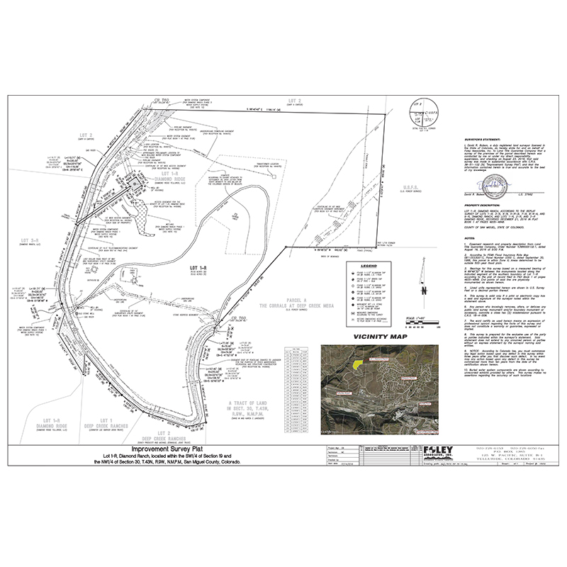
Improvement Survey Plat (ISP)
- Shows the location of all improvements (structures), visible utilities, easements, and rights of way
- Recovers or restores missing property corners
- Meets the standards of (link to CRS 38-51- 106)
- Meets all the requirements of a land survey plat while providing information of all improvements located on the property
- Shows visible encroachments on or within five feet of both sides of all boundaries
- A current title commitment is required
- May be recorded with the county to become public record
Click on Map to Download PDF
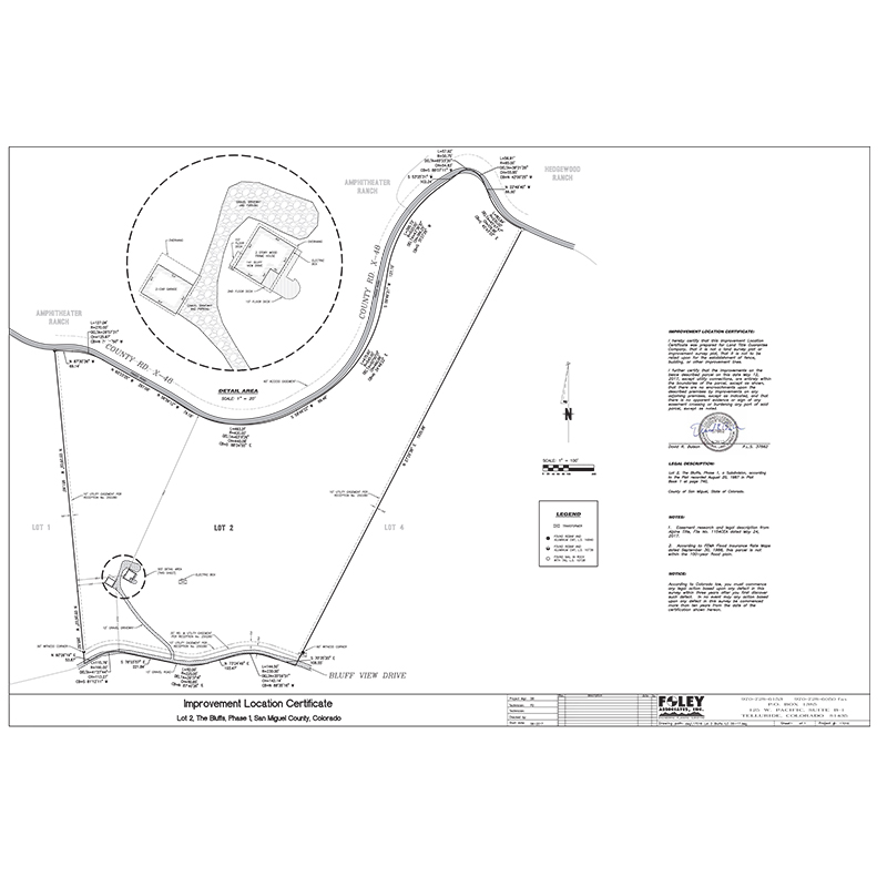
Improvement Location Certificate (ILC)
- An ILC is not a survey, but a certificate
- Used in order for mortgage and/or title companies to have some assurance that the improvements to a property are not encroaching into an easement or beyond the deed lines
- Does not set or recover property corners
- Does not verify acreage or lot dimension
- In most cases an ILC will be sufficient to show the relationship of the improvements to the deed lines
- If the ILC uncovers issues of concern an improvement survey plat or land survey plat, to determine property line location, may be necessary
- Meets the standards of (link to CRS 38-51- 105)
Click on Map to Download PDF
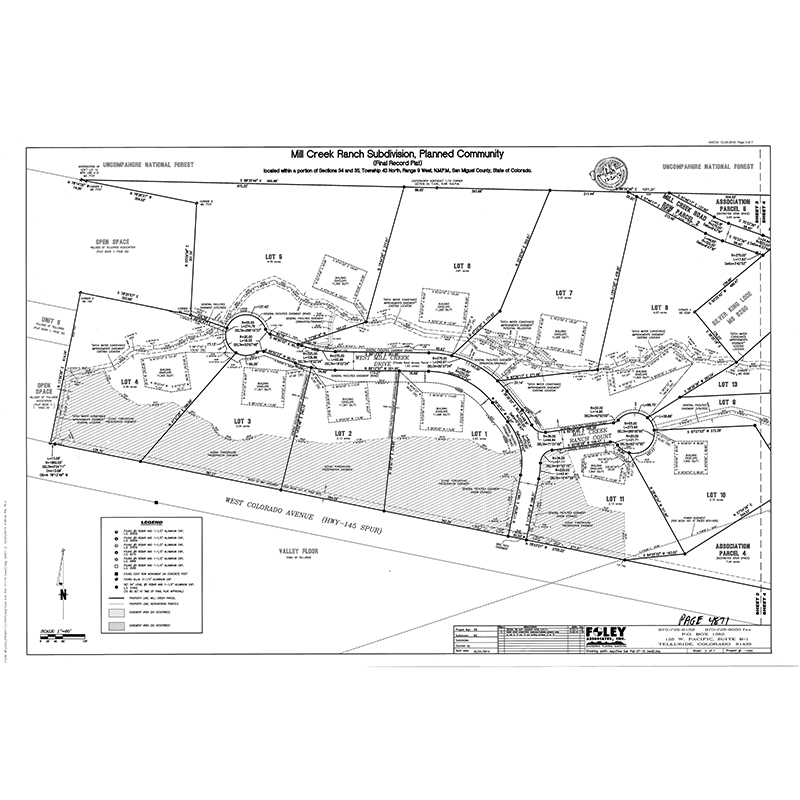
Subdivision Plat
- Divides land to create a new subdivision
- Adjusts lot lines of an already existing subdivision
- Eliminates or joins 2 or more lot
- A current title commitment is required
- Requires formal approval process with the governing municipality
- Recorded with the county to become public record
Click on Map to Download PDF
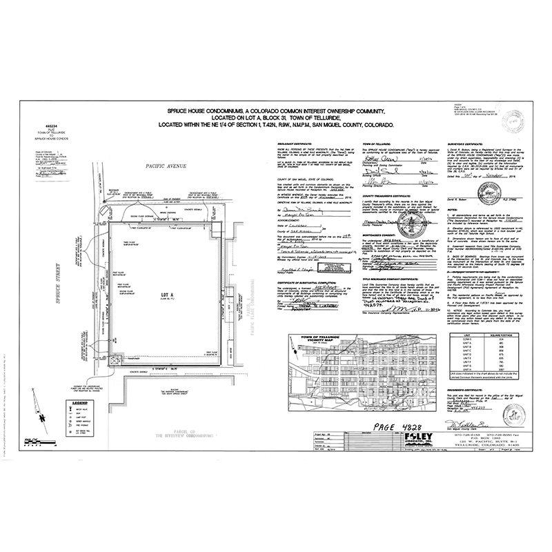
Condominium Map
- Divides a building into individual units that can be bought and sold
- Shows the improvements (structures) and the measured interior of the units
- General common elements are areas of common ownership, such as hallways and staircases
- Limited Common Elements are areas available for individual use, such as a deck, storage locker or parking space
- Shows the areas and volumes (airspace) of the interior General Common Elements and Limited Common Elements
- Recorded with the county to become public record
Click on Map to Download PDF